Thursday, October 29, 2020

Hope everyone is staying safe from the coronavirus and are having a good fall.   Looks like winter is trying to come early.  

A Pine-Cedar Lake Association Board meeting was held on September 19, 2020.   The notes from the meeting are in the attached.  

https://drive.google.com/file/d/13SgEJIdjblJF40ZFkp9uLLFvmWOMEVr7/view?usp=sharing

Saturday, August 29, 2020

Treasurer's report for fiscal year ending June 30, 2020

The attached is the Treasurer's report for 2019-2020.   Since the fiscal year end of June 30, 2020, additional members have joined and there are now 71 members for the Pine-Cedar Lakes Association.

https://drive.google.com/file/d/1rxv5SpV6CBXE-p7PEw3SoVe4r0UA0i4w/view?usp=sharing

Saturday, July 25, 2020

Annual Meeting Voting Results for the Pine-Cedar Lakes Association Board.

Thanks to everyone who responded to the Pine-Cedar Lakes Association annual mailing.   We were not able to have a face to face meeting but with the response from members we were able to have the association board voting accomplished.   The mail in date was closed on July 15, 2020 and the votes were counted.   Five people were on the ballot.  The top four votes were for Paul Jahnke--Treasurer, Gary Roerick--Vice President, Tom Lind--Director and Barb Skodje-Mack--Director.  They were re-elected to the lake association board for a two year term.   Thanks to Dave Maty for also running for the board.

Hopefully, we can have a face to face annual meeting next year on Saturday, July 3, 2021. 

Stay safe everyone and have a great summer on the lakes.

Monday, July 20, 2020

The water level on Pine Lake got a little higher on the weekend of July 17, 2020 with several more inches of rain.   As noted in the following post, the water from Pine Lake flows north and there is a culvert on the Northeast corner to Long Lake.   This culvert is blocked from time to time.   This past weekend, Randy Nilson and Travis Mack cleaned the culvert again.  Thanks to Randy and Mark for all their efforts in what is not the best place to work.   The following is a note and pictures that Barb Skodje-Mack forwarded.

Just an update on the Culvert on the north end of Pine Lake. It was clogged up and with property owner's permission, Randy and Travis cleared it out. Water is flowing again--which is good because the lake is up from all the rain.

Have a good week.

Barb


With the annual Pine-Cedar Lakes Association membership drive, there was a note asking if there were questions on lake water levels.   The following are questions received and response from Mark Anderson (DNR hydrologist):
According to Mark Anderson on September 27, 2019:
The average recorded water level is as it sounds, an average of all recorded water level data.  The DNR started recording water levels for Pine Lake in 1994 and Cedar Lake in 1998. 
Cedar Lake
Ordinary High Water (OHW) – 1209.33’
Current (9/27/19) water level – 1209.78’ (The basin is currently above the OHW by 5.4”)
Average recorded water levels – 1209.28’
Highest recorded water level – 1210.18’ (08/17/1999)
Pine Lake
Ordinary High Water (OHW) – 1245.10’
Current (9/27/19) water level – 1245.33’ (The basin is currently above the OHW by 2.76”)
Average recorded water levels – 1244.21’
Highest recorded water level – 1245.41’ (05/26/2019)
General water level questions:
1.       Thank you for the data you reported last September. What are the current levels for Pine and Cedar? I measured Pine Lake on 07/02/2020 and it was at 1245.04.  I have not measured Cedar Lake, but will try to get out there this week to get a reading.  The most current reading was 1209.26 on 06/22/2020
2.       Are there are OHW for Long Lake? There is no established OHW for Long Lake at this point.
3.       Any guidance for lake shore owners concerned about high water levels and erosion?  My first thought is a combination of rip-rap and native shoreland vegetation.  Typically rip-rap does not require a permit from the DNR, however it would require a permit from Morrison County.  I have attached some shoreline fact sheets. 

4.       What were some of the lowest recorded water levels for Pine and Cedar lakes? When was that? For Pine Lake 1242.58 on 08/18/1994 – For Cedar Lake 1208.26 on 10/01/2012
Here are a few Pine Lake Questions:
1.       Was the road at entrance to public access ever lower than now and water, when high, ran over?   This may be back in the 50’s to 60’s or earlier.  There is no evidence of overtopping of the road.  I know various individuals have stated there was an outlet culvert by the public access.  If there was a culvert there it was an “equalization culvert” to connect the two wetland complexes on each road.  Attached is aerial photography going back to the 1930’s and there is not visual evidence of this area ever acting as an outlet to Pine Lake.
The official OHW survey for Pine Lake was done in 1986, and they identified the norther route as the outlet for Pine Lake. 
2.       If the water flows north, what is route to get to Swan River?   Are there any blockages (like plugged culverts, beaver dams) on route?  Once water flows through Long Lake it travels via small streams and wetland complexes.  From there it can deposit into County Ditch 13 and County Ditch 8 which deposits to the Swan River. 
I do not know about blockages, my guess would be there are most likely some restrictions given the marshy nature of the outlet.  Perfect for beaver activity.
3.       Before roads were built around the lake on the southwest and southeast side, what direction did water flow out of Pine Lake?   Like in the 1800’s.  Unknown.  Given the aerial information I sent there is a lack of any evidence (channel) that water ever flowed to the southeast.  (see aerial link below)
4.       If water does not go down, what are options to manage lake level?  There might be an option of temporary pumping of up to 50 million gallons.  However, this is a one-time permit and a long term solution would be more challenging. 
Changing of an outlet is a time consuming and costly endeavor.   So, if there is a desire to lower the existing culvert, be prepared for a multi-year process and the costs associated with the permitting process. 
A centerline “equalization” culvert could be re-installed along the township road, with the Township approval.  This culvert would have to be set above the OHW of Pine Lake.
Here are a couple Cedar Lake Questions:
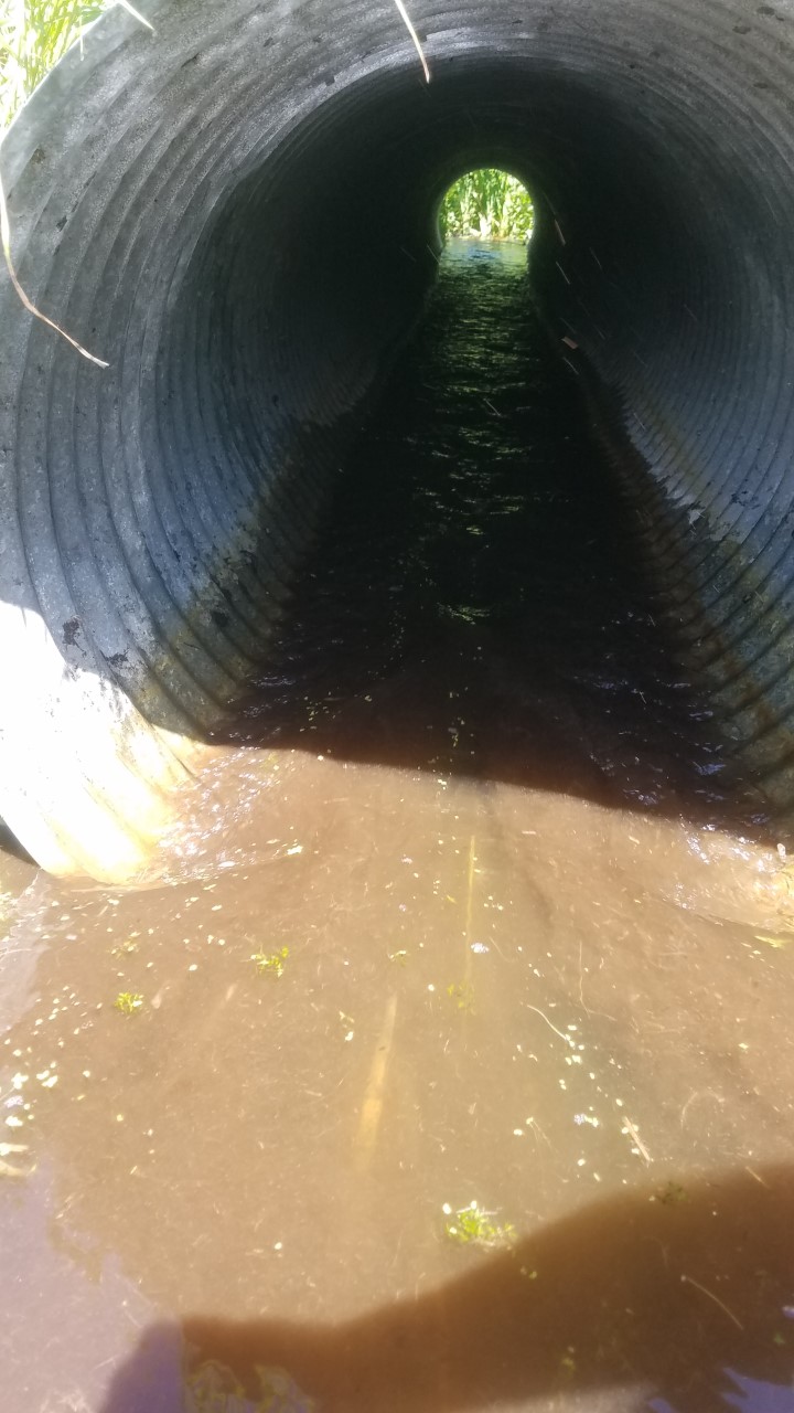
1.             How much lower is the current Culvert in the south east corner of Cedar Lake after the road reconstruction project than the previous Culvert was? If I recall correctly the culvert was inadvertently dropped approximately 5”.  This was corrected by installing a weir to match the previous elevation.
2.             Could somebody do soil and water testing on Cedar Lake to determine how much chloride is in the water/soil and then we could use that as baseline information when testing in the future, as they continue to put chloride on the road each year and that eventually some of it leeches and/or gets sprayed into Cedar Lake? The chloride water/soil tests would need to specifically be done along the South Shore adjacent to the road in the soil and along the South Shore in the water, since the chloride bonds to soil and other particles and stays there for ever and does not leech away.  This would be a question for MPCA, it might be something the Lake Association would like to take on.   Abaca Road (CR19) runs a distance of approximately ½ mile along the southern boundary of Cedar Lake.  This is significantly less than the basins in the metropolitan area where road infrastructure is considerably more.  I suspect the impact to Cedar Lake to be negligible. 
Questions gathered from Facebook:
1.             Is there algae on Pine Lake known to be toxic to humans or pets at this time?  Not that I am aware of.  I have not heard of any blue-green algae issues on either of these basins.


2.             Is it possible to have DNR monitor our public access so our waters remain free of invasive species? Are any other lakes doing that and how?  I would direct you to Adam Doll, he is the watercraft inspector coordinator.  His information can be found here:  https://www.dnr.state.mn.us/invasives/watercraft_inspect/index.html


The following link are a series of aerial pictures that are referenced in Mark Anderson's comments for the area by the Pine Lake public access.

https://drive.google.com/file/d/1C2BGxFOa2FLnsASt-4oVEQwHa95LVsAb/view?usp=sharing

The following links are articles from Mark Anderson related to shoreline issues.

https://drive.google.com/file/d/1Yw7YskwL8b1JmmuqUn6KZrQbFJYNzPrW/view?usp=sharing

https://drive.google.com/file/d/1Zo6hxUC_LlOLpe_aYmkEPBEHpuIh0ocL/view?usp=sharing

The following link is a mapping system that can be searched to find the Pine Lake and Cedar Lake areas.   It allows you to see elevations.   If you scan the map you can look at areas over a large distance.

http://arcgis.dnr.state.mn.us/maps/mntopo/


Monday, June 29, 2020

In the last three years plant surveys have been done on Pine Lake and Cedar Lake to determine plant types and density.   The surveys have been done to see extent of curly leaf pond weed (CLP) in both lakes and the amount of change in area over time.   With this blog, there is a better way to make the information available.   The survey was done by Limnopro in 2018 and 2019 and RMB Labs in 2020.  Evaluations for Aquatic Invasive Species (AIS) has also been done and reports are listed.

Plant survey report for 2018 for Pine Lake

https://drive.google.com/file/d/1wKDp368OX3I8gH5M-LLJ5vHusWemHRuW/view?usp=sharing

AIS report for 2018 for Pine Lake

https://drive.google.com/file/d/1OB16w97QB_1WP2TxiWXCYDnpxtEP0KD2/view?usp=sharing

Plant survey report for 2018 for Cedar Lake

https://drive.google.com/file/d/1F96kf6dt-iCbMygJkONaQEaXedulHf2W/view?usp=sharing

AIS report for 2018 for Cedar Lake

https://drive.google.com/file/d/1f-p2ih99sXv0Y4-ZcDqML8qML8oebDqC/view?usp=sharing

Plant survey report for 2019 for Pine Lake and Cedar Lake

https://drive.google.com/file/d/1ipoW-7Ou6-8h-D0I3FVleNz_CL6QeZ9P/view?usp=sharing

AIS report for 2019 for Pine Lake

https://drive.google.com/file/d/1CACmdBkteCizD5UDIsLDWDgcj_p4bMbn/view?usp=sharing

AIS report for 2019 for Cedar Lake

https://drive.google.com/file/d/1DJ0msL4_NM-PJOo6_f5JkELH2Uq_vsYh/view?usp=sharing

Plant survey for 2020 for Pine Lake

https://drive.google.com/file/d/17G9gQv-1WiUPIaNS3HGKPPXchcoOifyY/view?usp=sharing

Plant survey for 2020 for Cedar Lake

https://drive.google.com/file/d/1Ssr8FxjZ8IihWONwEhKc-NqQpRDms8aa/view?usp=sharing

Also in 2018 and 2019 testing was done for veliger (the babies) zebra mussels by volunteers on Pine and Cedar Lakes.  The tests are done in three locations in each lake and are done two times around the first part of July.  All tests were negative for 2018 and 2019.   The tests are planned again for 2020. 

In 2019 zebra mussel plates were built and were in both lakes.   These plates are intended to see if zebra mussels are growing in the lake.   There were no zebra mussels found in 2019 on the plates.
Additional plates were made and are in the lakes again in 2020.

Always be sure to CLEAN, DRAIN AND DRY your equipment.   AIS only moves by people using the waters and we want to keep the lakes clean of AIS we can avoid.

Sunday, June 28, 2020

Due to the COVID 19 the fishing contest will be cancelled this year.   Hope to see everyone at the contest next year.

Monday, June 1, 2020

"Do you have questions about Pine and Cedar Lakes?   Wondering about water levels, erosion, inlets/outlets, or culverts in the area?"

Pine-Cedar Lakes Association has reached out to Mark Anderson, DNR Hydrologist, to provide us with information.   Questions can be sent to the pinecedarlakes@gmail.com or Facebook page (Pine-Cedar Lake).   Questions and answers will be posted when complete.

Saturday, May 9, 2020

This blog is intended to capture information for the Pine-Cedar Lakes Association.


Treasurer’s Report, thru April, 2020, for Year Ending June, 2020
https://drive.google.com/file/d/1rxv5SpV6CBXE-p7PEw3SoVe4r0UA0i4w/view?usp=sharing

The following are the Pine-Cedar Lakes Association tell-conference board meeting on January 27, 2020


The following are the Pine-Cedar Lakes tell-conference board meeting on October 22, 2019
https://drive.google.com/file/d/1vlq0Nte6WHyVTTJOeI9nYZzGmu6oiArc/view?usp=sharing